Little Wigwam
✓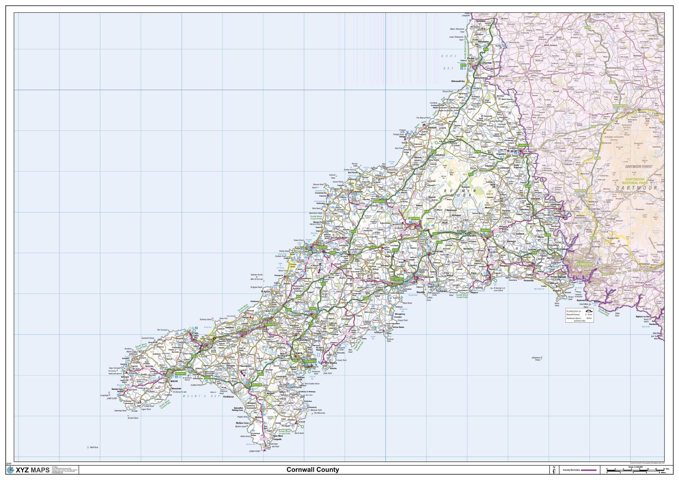
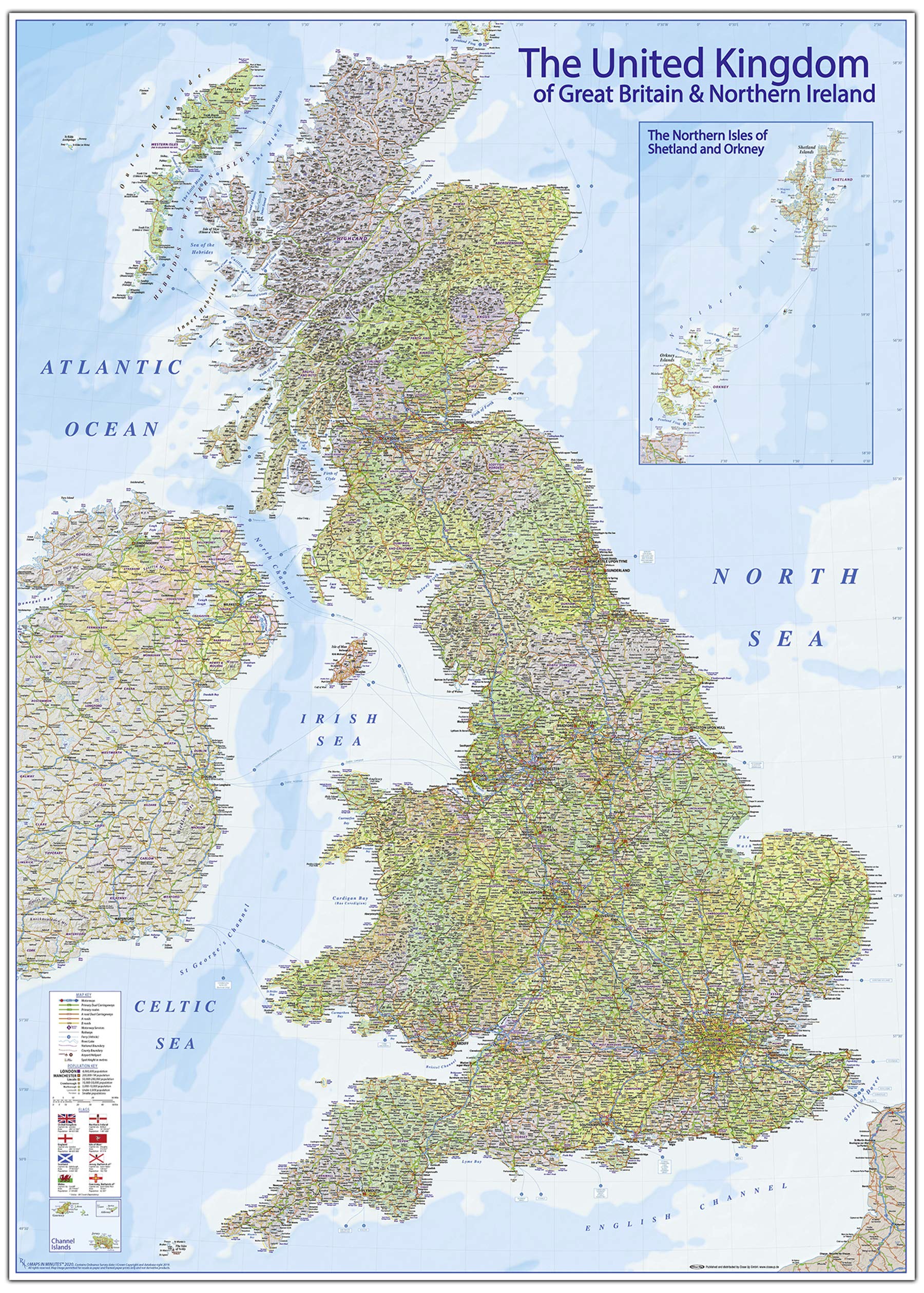
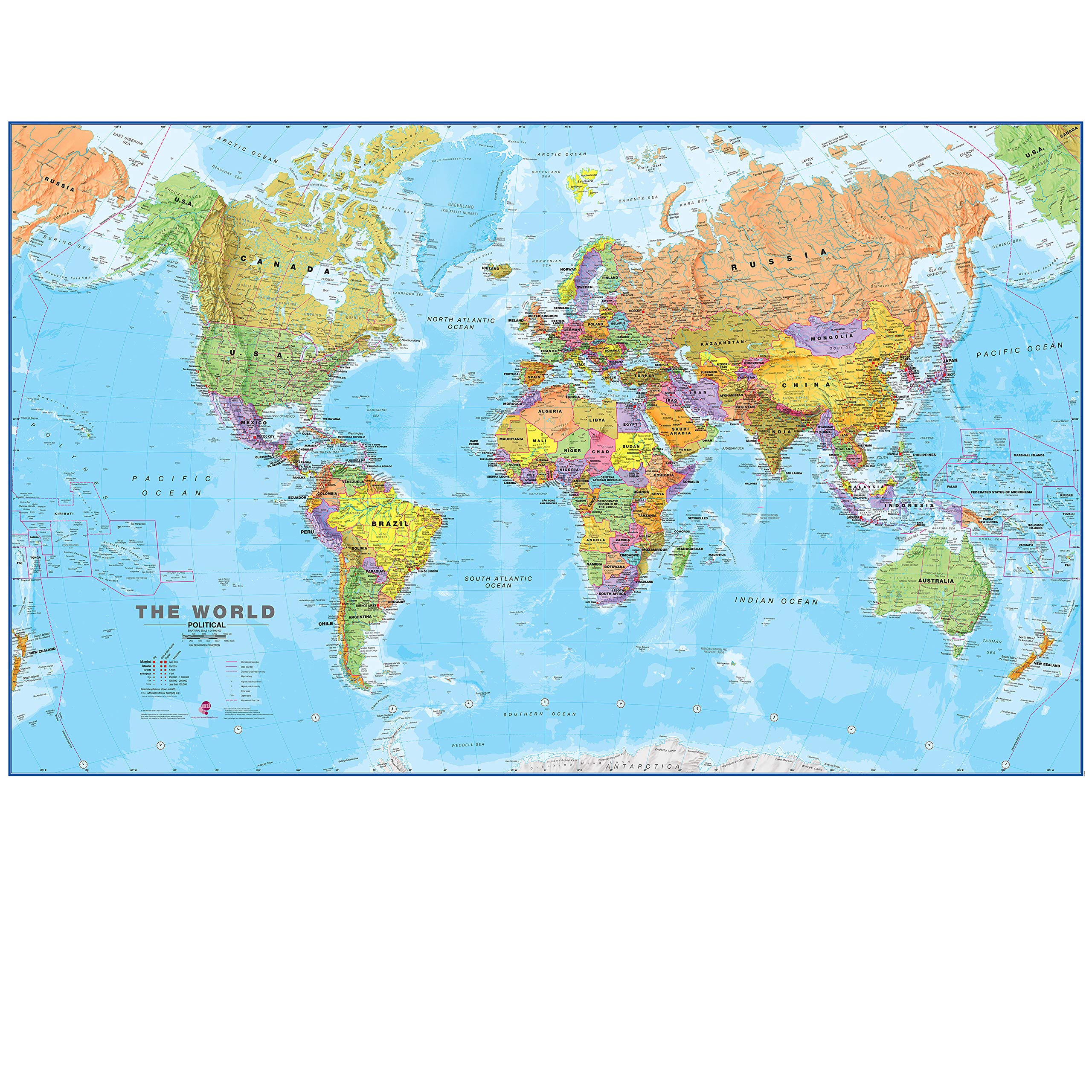
47 x 33.25 inches. Laminated. Flat map, tubed for shipping. This is a large ceremonial county map of Cornwall highlighting the county border, with the surrounding area faded out for excellent contrast. The map covers Bodmin, Bude, Falmouth, Fowey, Launceston, Lostwithiel, Mousehole, Padstow, Penzance, Redruth, St Austell, St Ives, Truro, St Neots, Saltash and Tintagel. The county map shows the latest County and Unitary Authority Boundaries, overlaid on a clear and easy to read Ordnance Survey map. Map created by XYZ Maps, one of Scotland's leading map publishers. Scale 1:140,000
Customer reviews
10 Trustpilot reviews total, with 2 shown at a time.
I wrote to Bigamart's customer support and they accompanied the process of reshipping the item until it finally arrived. I felt a genuine effort to solve the problem till it was finally solved.
The package was here in Australia from England in a few days — so quick! Something was missing and they refunded it straight away. Pretty happy with these guys.
You might also like